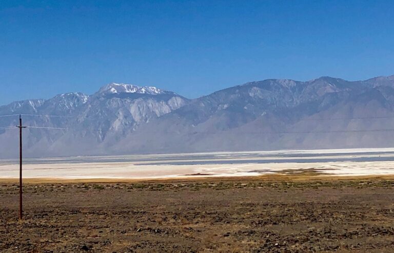
We got back on Hwy 395 and headed towards Lone Pine where we jumped on Hwy 126 which runs east of Owens lake and turns into Hwy 190 which will take us in to Death Valley. Owens Lake used to be one of the largest lakes in the US but in the 1920’s it was mostly dried up due to a diversion project to support the growing population in Los Angeles. Through the years there have been initiatives and attempts to restore the lake due to toxic dust storms. The lake is mostly a salt flat with an ecosystem that supports thousands of birds.
The road to the first Death Valley Park entrance sign is 36 miles from Lone Pine – the road winds through miles of soft sand and dessert flora. We started seeing Yuka and small Joshua Trees as we got closer to the park. Our plan was to drive through the park and see what we could from the van. We’re travelling with Ninja, our 12-year-old Schitzu-Llhaso Apso and as cute as he is, he isn’t welcome in most areas of the park and it’s much too hot to leave him in the van. We’re not sure what we’ll be able see, but so far the view has been beautiful.
Rainbow Canyon & Panamint Valley
Our first stop was the Father Crowley Vista Point with views of Rainbow Canyon created by volcanic activity layers. The canyon opens up to the vast Panamint Valley. We drove down a windy road with rock, arid mounds and hills and a stunning view of the Panamint Valley and mountain range in the distance. Panamint Valley is roughly a 50-mile-long basin with dunes at the north and China Lake at the south end. We crossed the Panamint Valley with waves of sand and rock at an elevation of about 2,000 feet.
Stovepipe Wells, Mesquite Flat Sand Dunes & Salt Creek
After crossing the valley, we climbed through the Panamint Mountain Range via Towne Pass at a summit elevation of 4,956 feet and descended back down into the Stovepipe Wells Village. The village got it’s name because when it was first established there were tents set up to provide travelers with a place to stay, food and water. Sand covered the tent village, so a stovepipe was used as a marker. There is a historical monument for “Burned Wagon Point” where the Jayhawker group broke away from the gold seeking pioneers, the 49ers, at Furnace Creek and headed north for a shorter route west and ended up in the valley where they burned their wagons, made jerky from their oxen and headed west on foot. A second group, the Bennett-Arcan party, tried to cross the Panamint Range but were unable to do so and sent a couple men out to get supplies. It took months for them to return and only two families had stayed to wait for them. As they crossed the mountains to leave the valley, one of the pioneers exclaimed “Goodbye, Death Valley” and that’s how the area got its name.
We continued on to the Mesquite Flat Sand Dunes and reached sea level! We are surprised at the grand vastness of this park – there are valleys and basins, mountains, hills, sand and rocks of so many different colors. We’ve been driving through the park continually to gawking, oohing and aahing! Past the sand dunes is the Devil’s Cornfield filled with the evergreen plants, Arrowweed, which were used by American Indians to make arrows. Along with the wealth of views, there is also a wealth of history.
The next scenic wonder is the Salt Creek. It’s early May and already the creek has mostly dried up with a few salty pools visible in the distance. In the winter and early Spring, the creek looks completely different with water flowing, green plants and pupfish. There is a half mile boardwalk that allows you to get right up to the water’s edge.
Zabriskie Point
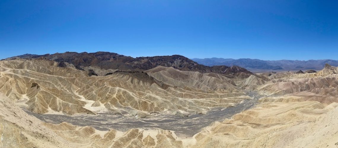
We stopped at the Furnace Creek Visitor Center and grabbed a souvenir map along with our Veterans National Park Pass – this is an awesome ‘thank you for your service’ gift and is much appreciated! Fifteen minutes up the road is Zabriskie Point. A quarter mile hike from the parking lot provides stunning elevated views of the grand, multi-colored wavy hills of the badlands with the salt flats of the valley floor and majestic Panamint Mountains in the background. The highest peak of the badlands is Manly Beacon named after one of the 49er pioneers to guide a gold seeking group out of Death Valley. An absolutely picturesque view created over millions of years.
There is so much to see and do in the park – the Artists Palette, Badwater Basin, Ubehebe Crater, and Wildrose Charcoal Kilns to name just a few of the most popular stops. I would definitely come back in the early Spring to see it in full dessert bloom and experience more of the amazing sites. We highly recommend visiting the Death Valley National Park! It’s hard to believe just two days ago we were at Lake Tahoe – what a significant shift in elevation, terrain and scenery but both are spectacular!
On to our campsite at Pahrump, Nevada for the evening and then Vegas Baby!
