We got an early start because we needed to ‘swing by’ Reno and visit Battle Born for a gadget that allows us to monitor our Victron MultiPlus charger/inverter via bluetooth and a cable to configure it using the app so we could make some setting changes. We’ll refer to Phil from now on as Inspector Gadget! LOL! We drove north from Zephyr Cove and took Spooner Summit via CA-50 east through the Carson Range towards Carson City. The summit is almost as high as Donner Pass with an elevation of 7,146 feet. The pass descends into a beautiful valley and for a bit follows along Clear Creek.

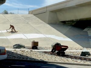
Here’s where it started to get windy. But driving through Carson City we were distracted by all the metal statue art on the overpasses along US-50 and I-580. We later discovered the artwork is a result of the DOT’s beautification requirement. Many states are planting greenery but in the high desert, the use of steel and stone is more practical and will last longer in the harsh environment. The scenes depict Eagle Valley and Carson City history.
Once we got through Carson City, the wind gusts were tossing poor Birdie all around the road. A wind advisory had been issued with sustained gusts of 45 – 50 mph! We made it to Battle Born and also stopped at Camping World before heading back on I-580 south to our planned BLM camp near Bishop. The wind hadn’t died down at all and we needed groceries, so we stopped at Carson City, bought groceries and found a great park for Ninja to get some grass time. During drive days we make sure to stop someplace where Ninja can play and roll around in the grass. We headed back to I-580 and started to see flashing wind warning signs directing any vehicles over 9 feet (that’s us) to exit and travel on a lower side road until merging with Hwy 395 south. Glad we weren’t up on the higher interstate because even on the lower road the gusts would suddenly pull Birdie. Phil did an awesome job driving through and keep Birdie on the road all while watching out for other drivers weaving around the road due to the wind.
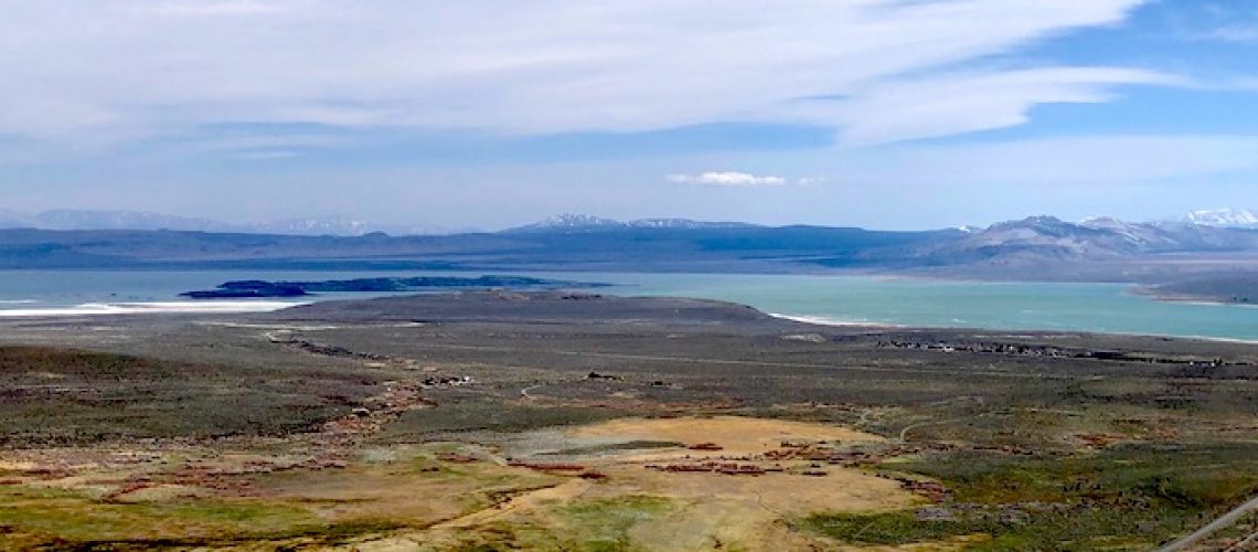
We eventually made it to Topaz Lake, crossed back into California and found some protection from the wind by the east side of the Sierra Nevada mountain range. 395 follows along West Walker River with pine trees and rocky terrain – we mentioned it reminded us of home in eastern Washington. The further south we headed, the landscape became mostly barren to the west that meets up with the Sierra Nevada snow-capped mountains including Mineral Mountain and Antelope Peak nearing 9,000 and over 10,000 feet high. Once we hit Sonora Junction, the river went west, and we headed east to climb through Devil’s Gate Pass which reaches over 7,500 feet above sea level and led us to the highest point on Highway 395 which is the Conway Summit at 8,138 feet (and we were worried about Donner Pass Summit at just over 7,000 feet – HA)! As the pass started to descend, we pulled into a viewpoint to appreciate the beautiful scenery and ask ourselves, “What lake is that off in the distance?”.

It’s Mono Lake. We had never heard of this ancient saline lake with its limestone tufa towers and delicate ecosystem. The lake is fed by a few creeks and doesn’t have an outlet to the ocean, so the salts remain as the water evaporates which raises the PH levels. It’s 2 to 3 times saltier than the ocean. The waters support brine shrimp which in turn feed hundreds of different bird species. The lake has an unearthly beauty with the calm blue water, white salty shoreline and knobby spiral tufa towers protruding around the lake. This is what I love about our travels – these accidental, stunning finds.
Just when we think the scenery can’t get any more beautiful, it does. After Mono Lake, we entered a densely forested area with the snow-covered Lookout Mountain and Sierra Nevada mountains seemingly suspended at the end and sides of the road. The trees became sparse, and we entered Owens Valley – an arid valley between the Sierra Nevada and White and Inyo Mountains. The mountains to the west of the valley are more than 14,000 feet and the lowest point in the valley is 4,000 feet which makes it the deepest valley in the US! The Inyo National Forest is filled with rugged mountain peaks, rivers, lakes, desert land and glaciers. What an incredibly beautiful area. We travelled through without stopping at the many wonderful sites available in the area which I can imagine are even more stunning.
We arrived at the BLM Horton Creek Campground in the early evening. It’s $8 a night with a fire pit, picnic table, lantern holders and pit toilets. We weren’t expecting much. I love it when low expectations are met with spectacular results! The sites were very large and far apart and the view was absolutely incredible – the campground is at the base of the Sierra Nevada mountains, specifically Mt. Tom and Wheeler Crest. The toilets were super clean too which is always a plus! The night skies were filled with stars I’m sure we’ve never seen before. An absolutely beautiful spot! And the name Horton Creek can’t be whispered without thinking of Dr. Seuss’ Horton Hears a Who! Tomorrow, Death Valley
